


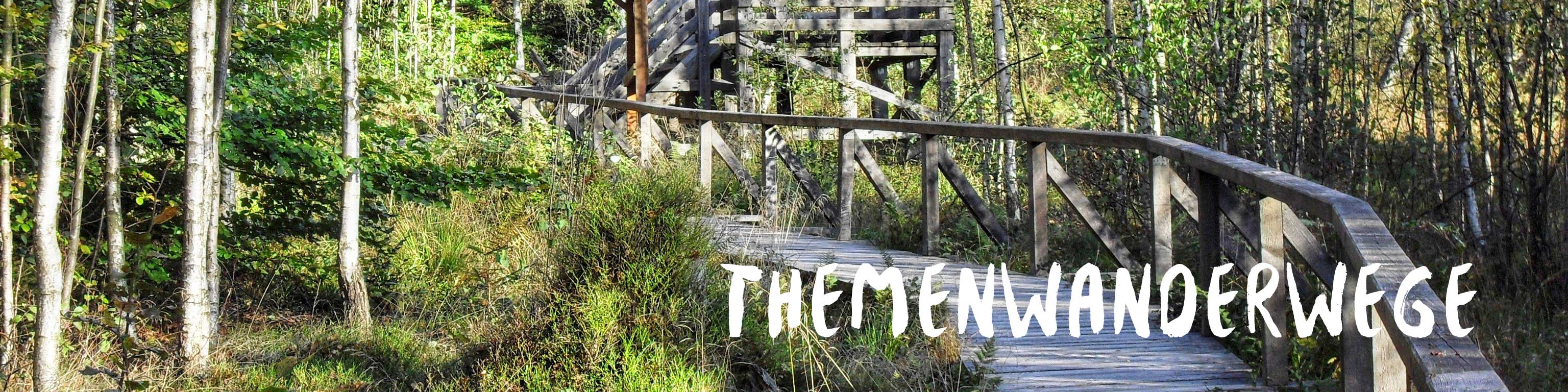
The »Themenwanderwege«
The Ruwer and its tributaries were restored to their natural state in the 1990s with the aim of maintaining the streams and marshes and developing them as a near-natural riverine and marshland landscape in the Saar-Hunsrück Nature Park. In order to bring visitors closer to this particular natural landscape, six themed hiking trails were created as part of the restoration work which focus on features of the local area. Flyers on each of the trails as well as information boards by the side of the path tell interested visitors more about this unique landscape.
RuT1 – Hiking is a joy for water creatures!
The route goes along forest paths by the side of the lake and the marshes of the Flonterbach stream into the Ruwer Valley about 2 kilometres away, where we follow the course of the stream through the idyllic valley. Hikers climb along gently rising paths up to the Fleschfelsen, large quartzite blocks which have withstood erosion, and from there back to the starting point. Apart from a short section of around 500 m, the trail is exclusively along forest paths.
Information leaflets on the circular hiking trails (RuT 1-6) as part of the “Ruwer and tributaries” water project with descriptions of the trails are available from the tourist information centre free of charge.
RuT2 – It’s more than just the greeny grass!
This themed hiking trail was created as part of the “Ruwer and tributaries” water project, a large conservation project carried out by the Trier-Saarburg district, whose main objective is to develop and maintain the Ruwer and its tributaries along with its marshes as a near-natural riverine and marshland landscape.
You will be impressed by the variety of species in the meadows along a 6 km walk in the central Ruwer Valley and around the Burkel stream. It has only become possible for these to emerge thanks to the wide and unused riparian strips which have recently been created. The restoration work has made space for nature here once again!
You start at the Mühlental hut in Mandern or at the Schieferberg hut near Waldweiler.
Information leaflets on the circular hiking trails (RuT 1-6) as part of the “Ruwer and tributaries” water project with descriptions of the trails are available from the tourist information centre free of charge.
RuT3 – A visit to the whinchat bird!
A varied walk around the town of Greimerath. Signs along the route tell you all about the project to install riparian strips along the Ruwer and the flora and fauna that live there.
With any luck you will be able to catch a glimpse of the whinchat along the 6.7 km walk around Greimerath, which find the marshes of the Panzbruch to be ideal breeding conditions. It is a migratory bird though, which means it can only be seen in the spring and summer months. The Taurus cattle can be seen grazing all year round however, since they have been placed there to maintain the damp pastures and so create the ideal breeding and living conditions for birds such as whinchats, snipes and meadow pipits, which would otherwise be threatened with extinction.
Information leaflets on the circular hiking trails (RuT 1-6) as part of the “Ruwer and tributaries” water project with descriptions of the trails are available from the tourist information centre free of charge.
RuT4 – Shadow play in the green gallery by the brook!
Be impressed and fascinated by the idyllic scenes that a stream can create when it is free to move and develop in its own way along a 7.5 km walk which is partially accompanied by the rippling sounds of the Ruwer. You begin at the leisure centre in Schillingen or at the Spießbratenhalle restaurant. Walking time: Approx. 3 hours
Information leaflets on the circular hiking trails (RuT 1-6) as part of the “Ruwer and tributaries” water project with descriptions of the trails are available from the tourist information centre free of charge.
RuT5 – In the dragonflies’ nursery!
Where, I hear you ask, does the natural-sounding name of this circular hike come from? Along the way you will see the Pionierweiher lake, where dragonflies thrive. An information board by the side of the lake tells visitors more about the “dragonflies’ nursery” and how they breed.
The circular hike to the Pionierweiher lake begins at the Sternfeld forest house on the edge of the Hochwald in Osburg. From here you hike in a clockwise direction, briefly touch the Misselbach valley, come into the Eschbach valley and then reach the Pionierweiher lake.
From the Pionierweiher lake the path continues downwards along the Eschbach valley. You hike across the southern flanks of the Beutelstein until the Eschbach flows into the Misselbach. Then the route turns to the right and follows the Misselbach back towards the Sternfeld forest house.
Information leaflets on the circular hiking trails (RuT 1-6) as part of the “Ruwer and tributaries” water project with descriptions of the trails are available from the tourist information centre free of charge.
RuT6 – History of the development in the Ruwer Valley around Sommerau!
We start our 5.5 km hike at the foot of the Sommerau castle ruins, which sit on a rocky crest high above the municipality of Sommerau at 320 metres above sea level. The very steep slopes in this part of the Ruwer Valley which are largely of no use for agriculture are covered with coppice, which results from trees repeatedly being harvested and shoots forming from the remaining roots which give rise to shrubby-looking trees.
Information leaflets on the circular hiking trails (RuT 1-6) as part of the “Ruwer and tributaries” water project with descriptions of the trails are available from the tourist information centre free of charge.